
Premium Precision Mapping Package
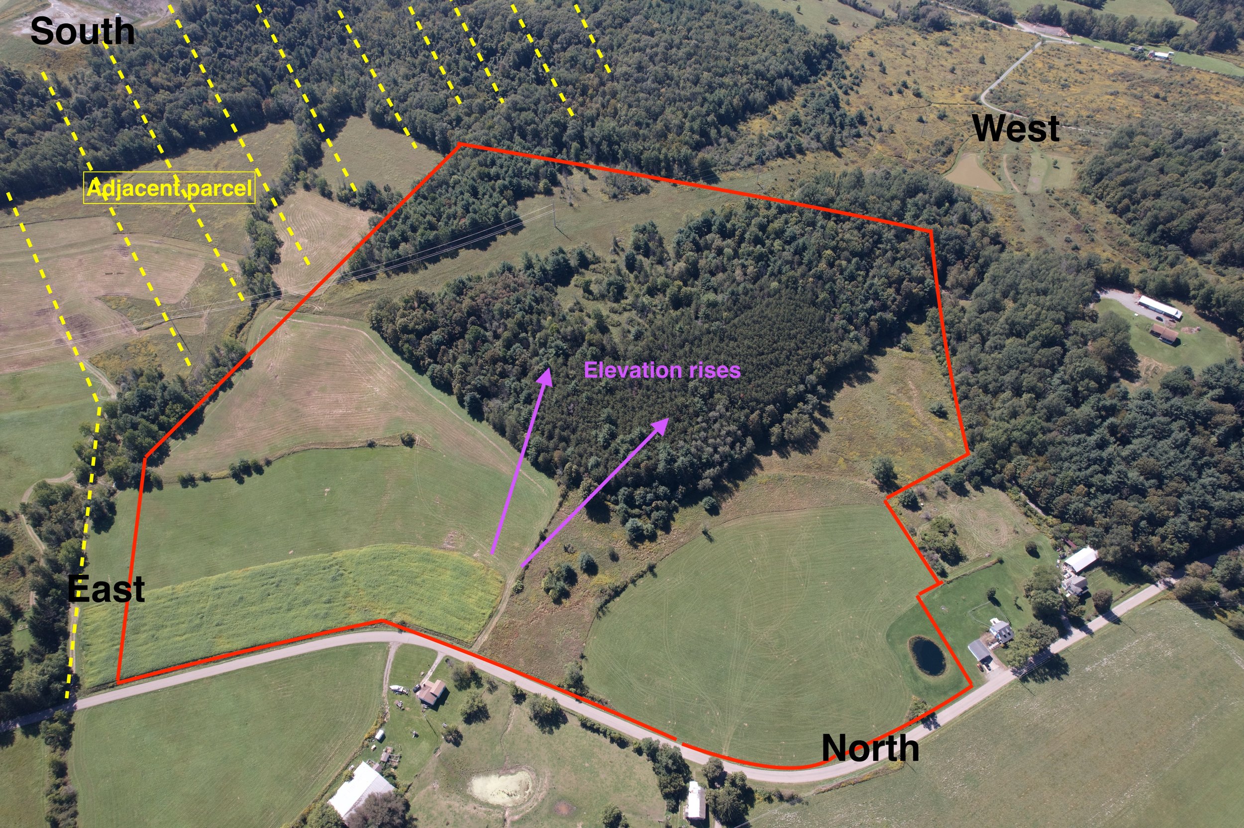
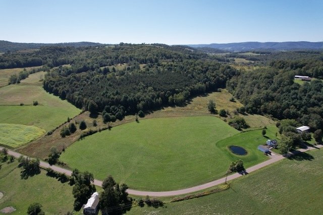
This premium package is excellent for precision surveys of fully built-out sites such as industrial buildings, large retail complexes, parking facilities, larger vacant lots and more. It includes Real-Time Kinematics (RTK geotagging) for sub-centimeter precision, a fully stitched orthophoto, establishing shots, rooftop POV shots and roof/soffit permitter shots. The orthophoto source photos can also be provided by request.
This premium package is excellent for precision surveys of fully built-out sites such as industrial buildings, large retail complexes, parking facilities, larger vacant lots and more. It includes Real-Time Kinematics (RTK geotagging) for sub-centimeter precision, a fully stitched orthophoto, establishing shots, rooftop POV shots and roof/soffit permitter shots. The orthophoto source photos can also be provided by request.

This premium package is excellent for precision surveys of fully built-out sites such as industrial buildings, large retail complexes, parking facilities, larger vacant lots and more. It includes Real-Time Kinematics (RTK geotagging) for sub-centimeter precision, a fully stitched orthophoto, establishing shots, rooftop POV shots and roof/soffit permitter shots. The orthophoto source photos can also be provided by request.